El Niño Canada 2026: What a ‘Super El Niño’ Actually Means for Canada and Ontario
For the past year and a half, Canadians have been dealing with the atmospheric stubbornness of a prolonged La Niña cycle. But as we move deeper into the year, climate scientists are tracking a massive transition.
El Nino Canada 2026 is rapidly becoming a trending topic, and for good reason. A rapidly warming Pacific Ocean is setting the stage for a powerful weather shift by late summer and fall. But what does this mean for your daily commute, your winter hydro bills, or your summer plans?
Here is everything you need to know about the impending climate shift, and why it might not bring the mild weather you are expecting.

The Science: Why the 2026 Transition is Different
We are not just looking at a standard, predictable climate cycle. Forecasters and researchers tracking Super El Nino predictions are keeping a close eye on the changing Pacific.
According to the March 2026 ENSO Diagnostic Discussion published by the NOAA Climate Prediction Center, there is a 62% chance of El Niño emerging by the summer months, with a 1-in-3 chance of it developing into a “strong” event by the end of the year.
Advertisement
When looking at El Nino vs La Nina Canada, the traditional understanding is relatively straightforward: La Niña (characterized by cooler Pacific surface waters) generally brings colder, harsher winters to parts of Canada, while El Niño (warmer Pacific waters) typically brings milder, drier conditions to the north.
However, this transition is fundamentally different because our planet’s climate baseline is already supercharged. Even during the recent La Niña phase, the Earth experienced some of its hottest years in recorded history. When the ocean transitions into an El Niño phase, it essentially “pops the lid” off the pent-up heat absorbed by the ocean.
Because this natural warming cycle is layering on top of human-driven climate change, scientists warn that we are entering dangerous territory.
As noted in the latest Global Temperature Report by Berkeley Earth, while early 2026 experienced some natural cooling, the looming El Niño threatens to push average global temperatures to dangerous new extremes, setting the stage for potentially unprecedented 2026 global temperature records as we move into 2027.
Advertisement
The Great Lakes Paradox: An Unpredictable Ontario Winter
If the globe is warming and El Niño brings milder air, you might assume that the Ontario winter forecast 2026 will be a breeze. Unfortunately, that is not the case. This is where the “Great Lakes Paradox” comes into play.
While Western Canada might see a generally milder and somewhat wetter winter, Eastern Canada—specifically Ontario—is bracing for severe volatility. A strong El Niño brings significant overarching heat, which means the Great Lakes are much less likely to freeze over early in the winter season. For millions of residents, this lack of ice acts as a massive atmospheric moisture engine.
When sharp Arctic cold fronts inevitably dip down over these unusually warm, open waters, the result is intense, highly localized winter storms. Therefore, Toronto El Nino weather might actually be defined by an increase in sudden, blinding snow squalls.
The Great Lakes lake-effect snow El Nino connection means that while the overall seasonal temperature might average out to be higher, the severity of individual storms could be much worse, bringing brief periods of zero-visibility, heavy, wet snow, and dangerous travel conditions.
From West Coast Rain to Extreme Global Heat
You don’t have to wait until next winter to see the atmospheric chaos; the clash of weather systems is already happening.
Right now, North America is experiencing a bizarre climatic split. While parts of the U.S. are trapped under a gigantic “heat dome” bringing record-breaking high temperatures, Canada is dealing with volatile spring swings. A quick look at the live Canadian Weather Alerts map for March 2026 shows Environment Canada tracking everything from winter storm warnings in British Columbia to sharp snow squall warnings in parts of Ontario.
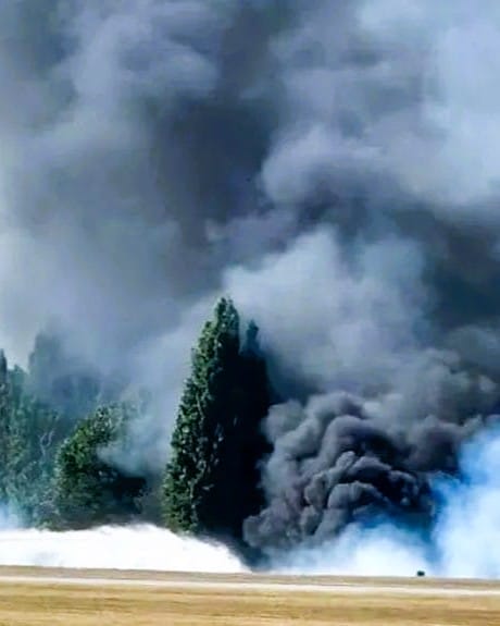
This stark contrast is a preview of what El Nino Canada impacts will look like. Heatwaves and droughts could become a massive threat this upcoming summer. We only need to look back at Canada’s devastating 2023 wildfire season—which torched roughly 5% of Canada’s massive forest lands and blanketed cities in smoke—to understand the risks of an exceptionally hot and dry summer amplified by a brewing El Niño.
How Canadians Can Prepare for the Shift
The arrival of an El Niño requires preparation, both for extreme heat and unpredictable winter storms. Here is how you can get ready:
- Summer Heat & Air Quality: With late 2026 poised to challenge heat records, ensure your home cooling systems are serviced early. If you live in areas prone to wildfire smoke, invest in HEPA air purifiers and familiarize yourself with local Air Quality Health Index (AQHI) resources.
- Winterizing for Lake-Effect Snow: If you live in Southern Ontario or near the Great Lakes, prepare for heavy, wet snowfall. Ensure your roof and gutters can handle sudden, heavy loads of precipitation, and always keep an emergency car kit packed for unexpected whiteouts.
- Stay Alert: Weather events driven by El Niño can develop rapidly. Download the WeatherCAN app or monitor Environment Canada’s alert portals to stay ahead of color-coded weather warnings in your local area.
While El Niño is a natural phenomenon, its modern impacts are anything but standard. By understanding the unique ways this global event alters local Canadian weather, you can stay safe and prepared for whatever Mother Nature has in store for the rest of 2026 and beyond.
You Might Also Like:
- Super El Nino: What is it and will it happen in Canada?
- WATCH — Why El Niño could make 2026 the hottest year ever recorded
- Canada’s 2026 Federal Minimum Wage Increase: Who Gets the $18.15 Raise?
Advertisement