Deadly Tornadoes Tear Through Midwest and South
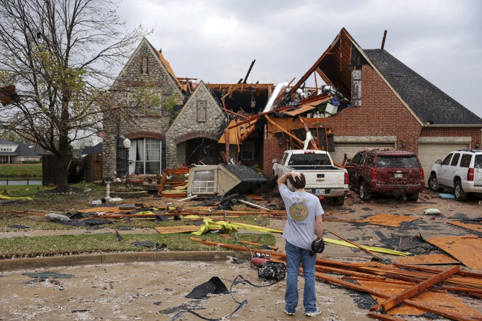
Tornadoes ripped through parts of the Midwest and South on Wednesday, April 2, 2025, destroying homes, toppling power lines, and heightening the threat of flash floods. Several regions, including northeast Arkansas, faced tornado emergencies as the severe weather caused power outages across six states.

Tornado Emergencies and Major Destruction
The National Weather Service (NWS) briefly declared a tornado emergency around Blytheville, Arkansas, warning residents of “a life-threatening situation.” Debris from the tornado was lofted over 25,000 feet in the air.
In Owasso, Oklahoma, a morning tornado ripped off roofs, damaged trees, and knocked down fences and power lines. Similar scenes unfolded in Pilot Grove, Missouri, where flipped cars and snapped power poles left residents cleaning up after the chaos.
Key areas affected by tornado activity:
- Blytheville and Harrisburg, AR
- Owasso, OK
- Nevada and Potosi, MO
- Brownsburg and Lowell, IN
Power Outages Across Multiple States
By late Wednesday night, the storms had knocked out power to:
- Nearly 90,000 customers in Arkansas, Mississippi, Missouri, Illinois, Kentucky, and Tennessee
- Almost 140,000 customers in Indiana
- Over 122,000 customers in Michigan, following a separate ice storm earlier in the week
PowerOutage.us confirmed that outages were widespread, with repair crews working around the clock in hazardous conditions.
Flash Floods Threaten Southern and Midwestern States
The Storm Prediction Center warned that the severe system is far from over. Rainfall could reach up to 15 inches in some regions by the weekend, creating conditions for life-threatening flash flooding.
Areas at highest risk include:
- Western Kentucky
- Southern Illinois and Indiana
- Northeastern Arkansas
- Southeast Missouri
Meteorologists say this level of rainfall is a “once-in-a-generation to once-in-a-lifetime” event. Roads may become impassable, and rivers could rise rapidly, endangering both urban and rural communities.
Millions Under Severe Weather Watch
An estimated 90 million people were at risk from Texas to Maine. Over 2.5 million residents were placed under a rare high-risk alert, including those in:
- Memphis, TN
- Western KY
- Southern IL
- Northeast AR
- Southeast MO
These areas could experience multiple long-track EF3+ tornadoes, with storms capable of staying on the ground for miles, causing extensive destruction.
Roads Closed, Buildings Damaged, and Tornadoes Still Possible
Authorities in Indiana reported semis blown over on I-65, and a warehouse collapse in Brownsburg. In Kentucky, even the NWS Paducah office took cover during an overnight warning, highlighting the unpredictability of the storms.
Meanwhile, the Mackinac Bridge in Michigan was closed due to falling ice — the third straight day of closures — adding to the region’s weather-related challenges.
What Comes Next
The NWS predicts the storms will continue eastward through Saturday, with repeated waves of heavy rain likely in Texas, the lower Mississippi Valley, and the Ohio Valley. The risk of flash flooding remains high due to a stalled weather front.
“I don’t recall ever seeing one like this,” said NWS meteorologist Mark Rose in Tennessee. “It’s not moving.”
Safety Reminders
Officials are urging residents in affected zones to:
- Monitor local forecasts and alerts
- Avoid driving through floodwaters
- Have emergency plans ready
- Charge essential devices and prepare for outages
As the storms continue to threaten millions, preparedness and vigilance remain crucial.
More…


