Winter Storm Warning Update: Blizzards Slam Prairies, 40cm Snow & Flash Freeze Target Ontario/Quebec
A massive weather system is battering central Canada, triggering urgent winter storm warning from the Prairies to Quebec. Southern Manitoba and Saskatchewan face blinding blizzards today. As the storm tracks east, it will dump heavy snow on Ontario and Quebec by Friday evening.
Manitoba and Saskatchewan: Ground Zero
Southern Manitoba woke up Thursday morning to whiteout conditions as a powerful “Alberta Clipper” system intensified.
- Blizzard Conditions: Gusts reaching 80 km/h are whipping up snow, creating near-zero visibility across the Pembina and Red River Valleys.
- Impact: Winds will ease by supper, though loose blowing snow will still restrict visibility.
- Accumulation: Southern Manitoba received 10 to 15 cm of snow overnight. Meteorologist Chris Sumner confirmed the substantial accumulation.
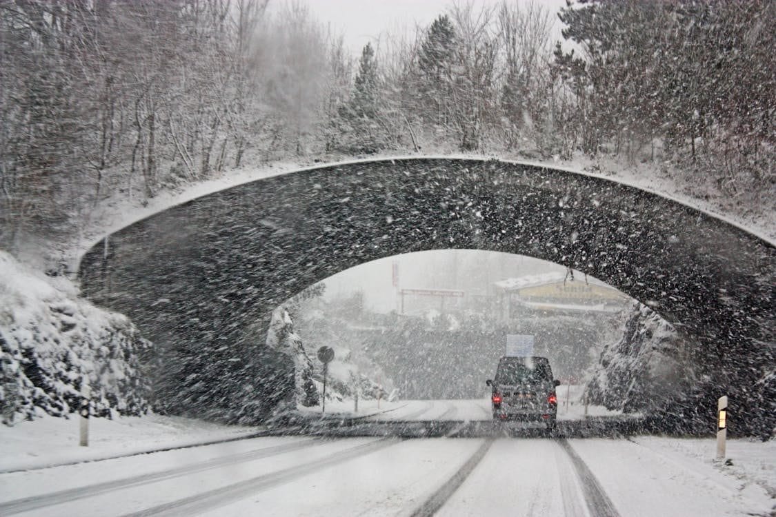
Ontario and Quebec: The Next Targets
As the low-pressure system pushes east, it is setting its sights on Central Canada. Winter storm warnings have now been issued for north-central Ontario and into Quebec.
- Heavy Snowfall: Residents in Northern Ontario (specifically the Kenora to Thunder Bay corridor) should prepare for 20-30 cm of snow, with localized amounts reaching up to 40 cm due to persistent snow bands.
- Flash Freeze Risk: A sharp cold front trailing the storm will cause temperatures to plummet rapidly from near freezing to below -15°C. This will trigger a “flash freeze,” turning wet roads into dangerous sheets of ice instantly.
- Quebec Impact: Strong southwesterly winds gusting up to 90 km/h will sweep through Greater Montreal, Drummondville, and Bois-Francs on Friday afternoon, threatening power outages and structural damage.
The Deep Freeze Follows
Perhaps even more dangerous than the snow is the wall of Arctic air chasing the tail of this storm. As the system moves out, high pressure is ushering in bone-chilling temperatures.
- Northern Regions: Across northern Alberta, Saskatchewan, Manitoba, and Ontario, extreme cold warnings are in effect with wind chills plummeting to between -45°C and -50°C.
- Southern Regions: Manitoba’s southern areas will see overnight lows dip to -27°C tonight, with the wind chill making it feel like the mid -30s.
Alberta’s Aftermath: A Warning for Drivers
The severity of this system was fully realized yesterday in Alberta, where icy roads led to chaotic scenes. Police responded to a massive pile-up involving 80 to 100 vehicles on the Queen Elizabeth II Highway between Calgary and Airdrie, forcing the closure of the major route for hours.
Looking Ahead: No Relief in Sight
For the Prairies, the respite will be brief. Forecasters are already tracking a third Alberta clipper expected to arrive in Southern Manitoba on Friday. Although less severe than today’s event, the incoming system will bring another 5 cm of snow and gusty winds, further complicating cleanup efforts.
Stay off the roads if possible, monitor local alerts, and ensure your emergency kits are stocked.
Related Reads:
- Winter storm system that brought traffic chaos to Prairies moves into Ontario, Quebec
- Major winter storm arrives, significant impacts underway including cancellations – PembinaValleyOnline.com – Local news, Weather, Sports, Free Classifieds and Business Listings for the Pembina Valley, Manitoba
- Manitoba blizzard: Schools closed amid winter storm